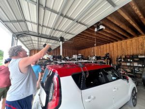
Edmonton, AB (Sept. 28, 2022) – GeoVerra team members, Andrew Hill, Blaine Paluck and Tyler Arthurs went down to the LidarUSA HQ in Alabama for two days of Lidar training in August. The primary application of the new S32+ unit is to be mounted to one of our UAVs (drones), but this unit is capable of being mounted on ANY type of vehicle such as a helicopter, car, truck, rail, boat, UTV, or even on a person.
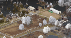
If you’re not familiar with Lidar, don’t worry, we’ll explain first. Lidar also LIDAR, or LiDAR; is a method for determining ranges (variable distance) by targeting an object or a surface with a laser and measuring the time for the reflected light to return to the receiver. It stands for “light detection and ranging” or “laser imaging, detection, and ranging”. It is sometimes used interchangeably with the term 3D laser scanning.
So, having this level of flexibility that comes with the new S32+ is a huge advantage for GeoVerra since the new unit can be deployed as an aerial or ground-based mobile mapping system (MMS), if project specs allow, and it can perform the most demanding MMS jobs in a pinch. And not to forget about efficiency, the range, very high-quality Inertial Measurement Unit (IMU) and high point density combination allow us to fly our UAV at maximum altitude while covering much larger areas with each pass.
“Compromise” is the general word to use when it comes to Lidar sensors. You get what you pay for. To further expand, the cheaper repetitive scanners have no benefit from the angle of attack, so getting under vegetation is only up to the power of the laser itself. When it comes to getting through and under vegetation, a primary reason we would need lidar, the 32M is very hard to beat. GeoVerra’s National Manager, Geospatial and RPAS Operations, Leon Hanlan, says, “Some systems might be better at one element, but none are as good all round for applications in the air and still be capable on the ground.
Get to know the S32+
- Range: 225 meters in all directions
- Pulse rate: 1,280,000 points per second | 300-600 points per sq meter
- Angle: 360 degrees horizontal FOV and 30 degrees vertical FOV (+15 / -15 from perpendicular)
- Lasers: 32 beams and 2 returns on each
- Camera System: Twin oblique 35mm APSC sensors with25mm lenses for aerial applications.GoPro 360 for lower quality colorizing360 degree 60MP highway camera on ground.
- Accuracy: 2-5cm depending on application
- Power: Supplied via on board the drone. On the ground, a portable power bank – 1000watt-hour will run it all day.
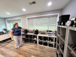
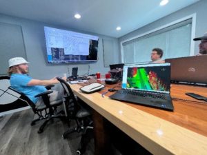
See below for some images of our team in training sessions in Alabama, industrial 3D printers and the Lidar unit being installed on a vehicle.
Many types of systems for many applications. The GV S32+ system offers the most versatility with the fewest compromises on any system. Some systems might be better at one element, but none are as good for applications in the air and still capable on the ground. The INS is one of the best on the market and the support team at LidarUSA is top-notch. We’re excited to have access to the S32+ as we continue to grow our advanced technology at GV.
Learn more about the services GeoVerra offers with the latest and great technology here.