Advanced
Technologies
Technologies
to do more.
While there will always be a time and place for traditional surveying, GeoVerra embraces technological innovations to advance the industry and support clients in an increasingly data-driven world. By investing in technology year after year, we’re setting a new standard in reality capture and digital transformation.
Geospatial Services
If it’s visible, it can be scanned and modelled. We use industry-leading, cutting-edge technology to deliver reality capture services to diverse industries. From terrestrial laser scanning to mobile mapping, UAV imaging to LiDAR, and GPR to bathymetric surveys (to name a few), our non-invasive solutions produce precise, reliable data in a fraction of the time and cost of conventional survey methods.
Products and Solutions
The data is there, but what can you do with it, who is going to see it, and how do you make the most of it? Our tools and platforms transform complex data sets into powerful and meaningful information so that you can make data-driven decisions, and design and build with confidence. From GIS to BIM and web portals, we provide customized and intuitive solutions that make data more accessible and insightful than ever before.
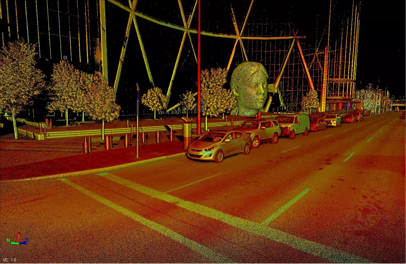
Mobile Mapping
Mobile Mapping Systems (MMS) are advanced lasers affixed to moving vehicles that scan and capture 360 degrees of their surroundings. We use this LiDAR technology to measure objects down to the centimetre, by millions of points per second, collecting data on literally every visual component. Clients can easily access this new class of digital data for a totally immersive and accurate 3D view of their project. At GeoVerra, we use the best of the best. Our complete mobile mapping solution combines leading-edge hardware with intuitive field software and a powerful, integrated office software workflow. This efficient, high-performance mobile mapping system rapidly captures laser scans and images, both panoramic and multi-angle, as you drive, making it ideal for large survey, engineering projects, and asset management.
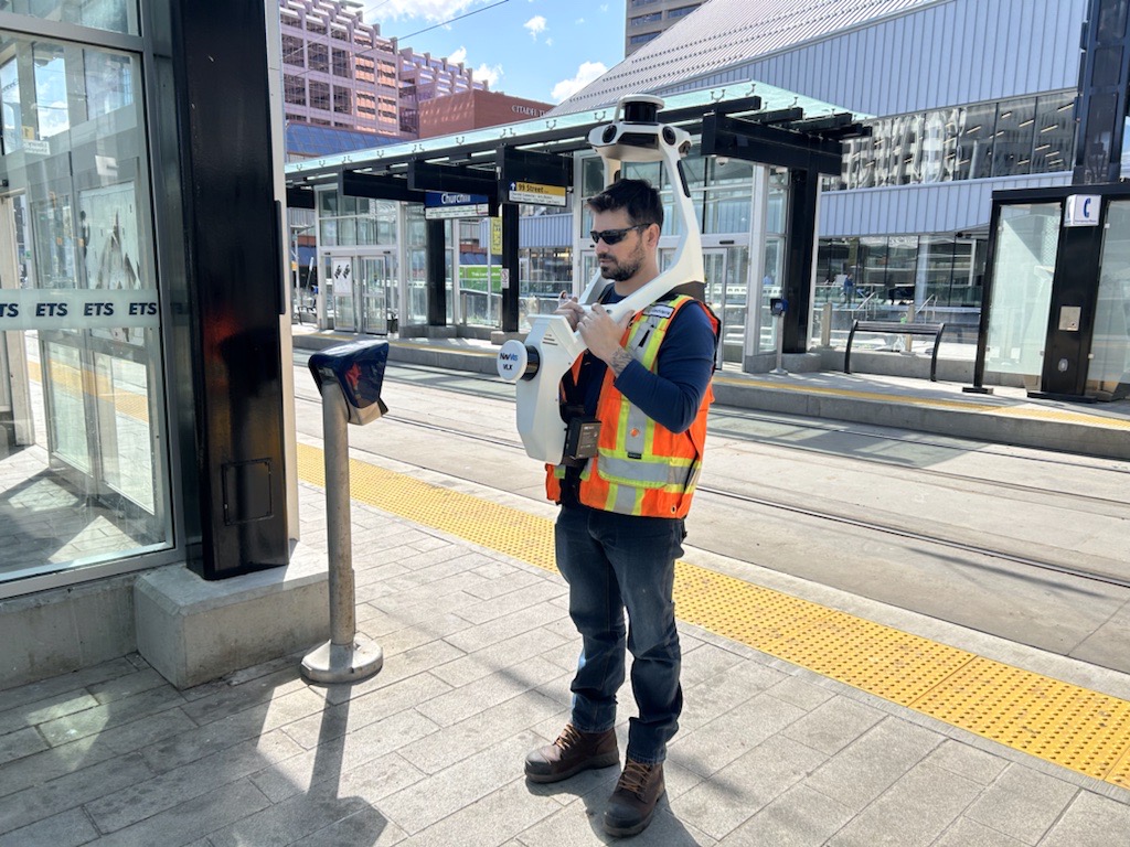
Wearable Mobile Mapping System (W-MMS)
GeoVerra’s Wearable Mobile Mapping System (W-MMS) is redefining how complex geospatial data is captured indoors and outdoors. By pairing cutting-edge technology with unique indoor and outdoor solutions, with industry expertise, we provide faster project turnaround, reduced site disruption, and enhanced safety- without compromising on quality. This versatile system collects highly detailed, georeferenced 3D data making it ideal for everything from asset management and digital twins to construction progress and urban topo surveys. With efficient data extraction and visual deliverables like 3D models, BIM, and virtual tours, W-MMS supports better collaboration and smarter decision-making across engineering, energy, infrastructure, and more.
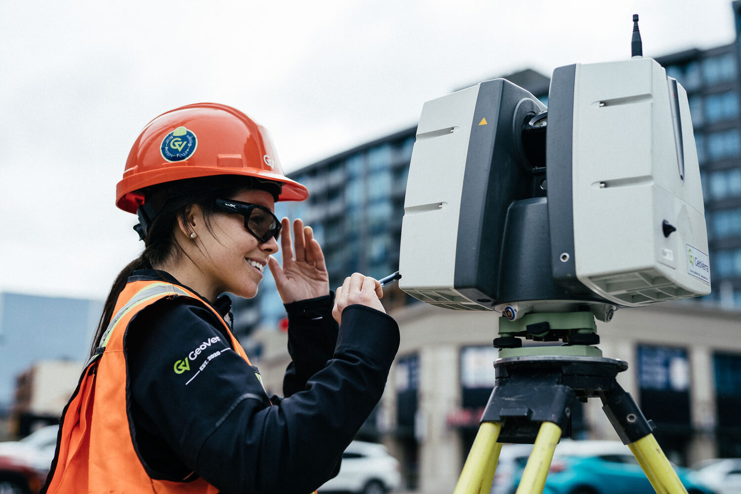
Laser Scanning
Laser scanning emits laser pulses toward coordinates, measuring the distance between the device and its target. With 3D scanning, we’re able to collect thousands of data points per second, in a fraction of the time it takes using conventional survey methods and provides a means of storing geospatial data for informed decision making and optimized operations. From the most advanced traditional scanners to the new wearable scanners that can be used to capture in greater details anywhere accessible by foot, these unobtrusive scanners are safe, thorough and cost-efficient; reducing facility downtime and return visits to the site.
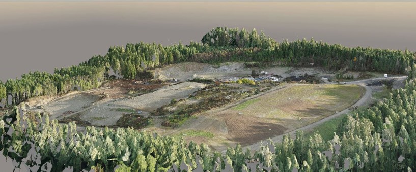
Unmanned Aerial Vehicles (UAV) and LiDAR
Unmanned aerial imaging is a proven and trusted technique for collecting precise geospatial data with remote (LiDAR) and photogrammetry (RGB) sensors. UAVs help us perform quick, high-definition surveys (HDS) across large, complex, and even hazardous areas while keeping everyone out of harm’s way. Using the latest fixed-wing and multi-rotor drones, our licensed pilots can fly different types of payloads, and collect and model LiDAR data during flight for real-time structural and infrastructure inspections.
GeoVerra’s Flight Management Program was developed using FLYsafe by AIRmarket, a platform built with large enterprises in mind. It allows our UAV pilots to focus on the task at hand – collecting data for your operations. The enterprise platform supports site assessments and operations in compliance with Transport Canada and supports Beyond Visual Line of Sight (BVLOS) missions.

Bathymetric Surveys
Bathymetric surveys capture detailed data in a fraction of the time it takes traditional survey methods. We use manned and unmanned boats with RTK GNSS receivers, which take in the normal signals from global navigation satellite systems along with a correction stream to achieve positional precision down to the centimetre. Tethered to single-beam or multi-beam echo sounders, they collect and record accurate depth readings. Our field crews are Swift Water Safety certified and equipped with the technology to access watercourses of any size and complexity, safely, efficiently, and non-invasively. This means reduced time on the water and fewer return visits to the site.
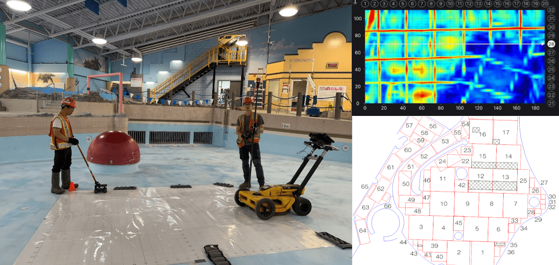
Ground Penetrating Radar (GPR)
Ground penetrating radar (GPR) technology is a non-invasive, non-destructive method of geophysical surveying that uses radar pulses triggered by odometer movement to image and produce a 2D cross-section of the sub-surface. Compared to other techniques, like infrared thermography, ultrasonic, or microwave, GPR’s penetrating power can detect defects, deterioration, and anomalies at greater depths — perfect for buried utility or buried object locating, archaeology, bridge inspections, ice thickness mapping, and concrete inspections.
GPR is relatively efficient at collecting large amounts of data and is highly accurate when operated by our team of skilled professionals.

Smart Integrated Solutions
We utilize metric digital cameras and close-range photogrammetry to provide for progress, change, and condition monitoring. Our technologies create dense point clouds based on image-matching or Surface from Motion (SfM) algorithms. Effective in moist environments, the survey-grade accuracy point clouds can be compared to the original design or to point clouds at different epochs to monitor structural deformations in transportation corridors, buildings, bridges, dams, and other infrastructures subjected to extreme events or natural aging.
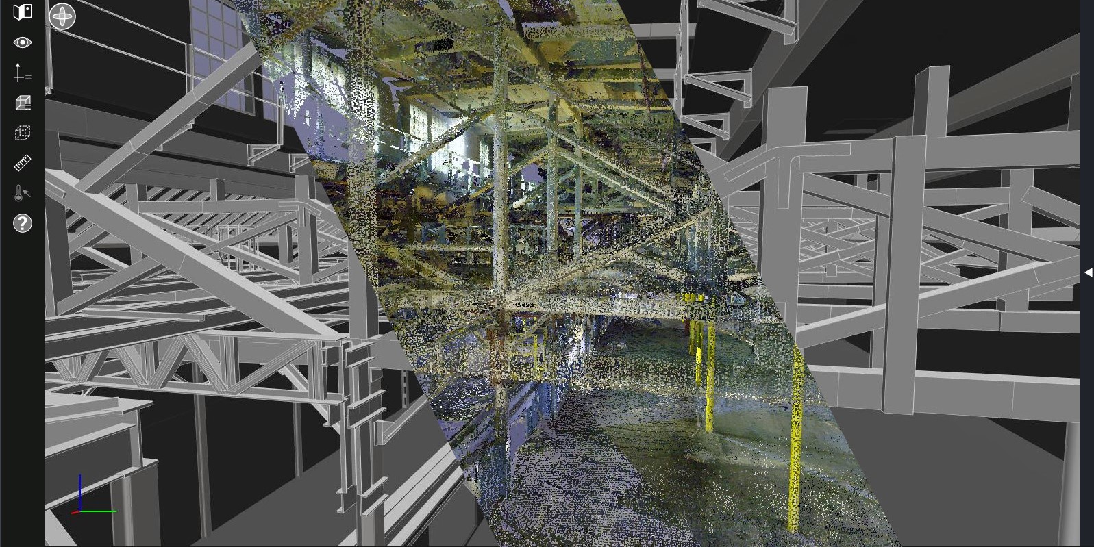
Digital Twin Solutions
We can generate a precise digital replica of the physical world, known as a Digital Twin. This solution provides clients with insights about how to improve operations, manage assets, help with construction and design, increase efficiency, and reduce operational costs while avoiding additional field trips.
- GIS and 3D web portals
- SCAN to CAD
- SCAN to BIM (Building Information Modeling)
- Point cloud
- High-resolution modelling
- Smart modelling
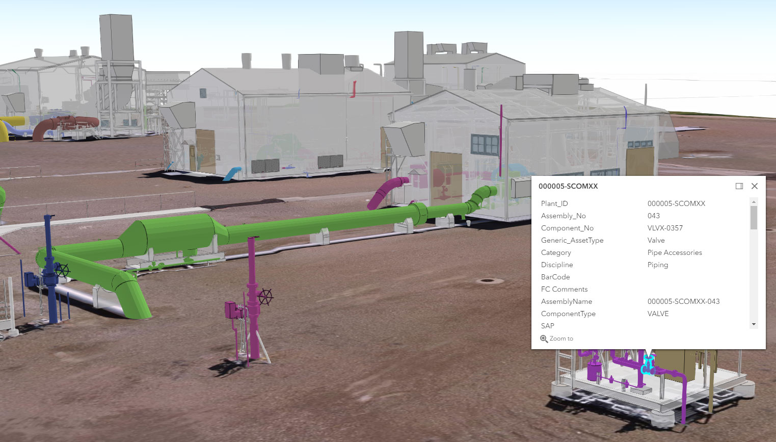
Geospatial Data Products and Analysis
Thanks to our high-end reality capture sensors, we collect very dense and precise geospatial data that can be used to generate geospatial products and data analyses that help our clients improve decisions and find solutions.
- Pavement analysis reports
- Tank inspections
- Pipe fitting analysis
- Volume calculations
- Asset management
- As-built dimensional control plans
- 360 Images for virtual site visits
- Planimetric and topographic plans

Photogrammetry and Remote Sensing
We have a variety of photogrammetric and remote sensors that capture an extensive array of wavelengths and imagery. They help us gather data for terrestrial projects like mapping, environmental impact assessment, earthworks, mining, and more.
- Stereo photogrammetry — fixed-wing (manned) UAV and high-resolution satellite
- Topographic mapping
- Digital Terrain Models (DTM)
- Remote sensing
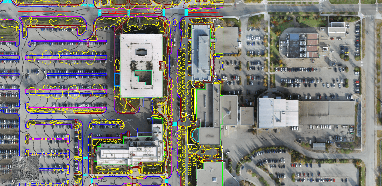
Smart Solutions
Recent enhancements in computer processing power have advanced the geospatial industry with the development of many hardware and software smart technologies. We’ve embraced the best smart geospatial solutions available on the market to provide our clients with innovative and efficient solutions.
- SLAM solutions
- AR/VR solutions
- Smart detection, classification, and extraction using artificial intelligence (AI)/machine learning (ML)
Technologies for every sector.
At GeoVerra, technology isn’t an afterthought. It’s something that we’ve incorporated into our everyday operations and conversations, and embraced to advance our industry and yours. Although we may be down-to-earth, we’re all about saving our clients time and money while keeping safety top-of-mind. From customized portals for construction progress to mobile mapping for asset management, our geospatial team does it all. Other companies simply don’t have the people with the experience and knowledge we do to filter the data and make it useful, make it meaningful.
Latest News
The Future of Mining Site Development: Reducing Downtime with Smart Surveying & Monitoring
May 28, 2025
Edmonton, AB (May 28, 2025) – In Canada’s fast-evolving mining industry, efficiency, sustainability, and precision are key to staying ahead. Today, mining projects often face common challenges: unexpected delays, profitability, […]
The Key to Smarter Transportation Infrastructure: Why Geospatial Solutions Are Critical
April 23, 2025
Edmonton, AB (April 23, 2025) – From coast to coast, Canada is experiencing a boom in major transportation infrastructure. Whether it’s the expansion of national highways, the modernization of rail […]
